Khuyến mãi và Cách thức mua hàng
Giao hàng miễn phí máy định vị Montana 600
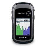
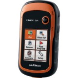
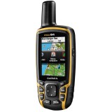
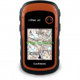
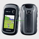
 Máy định vị vệ tinh GPS
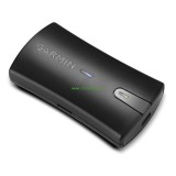
 Phụ kiện máy định vị
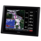
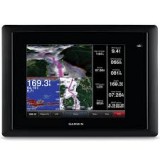
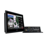
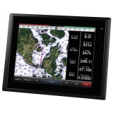
 Thiết bị hàng hải
 Thiết bị đo

Giao hàng miễn phí máy định vị Montana 600
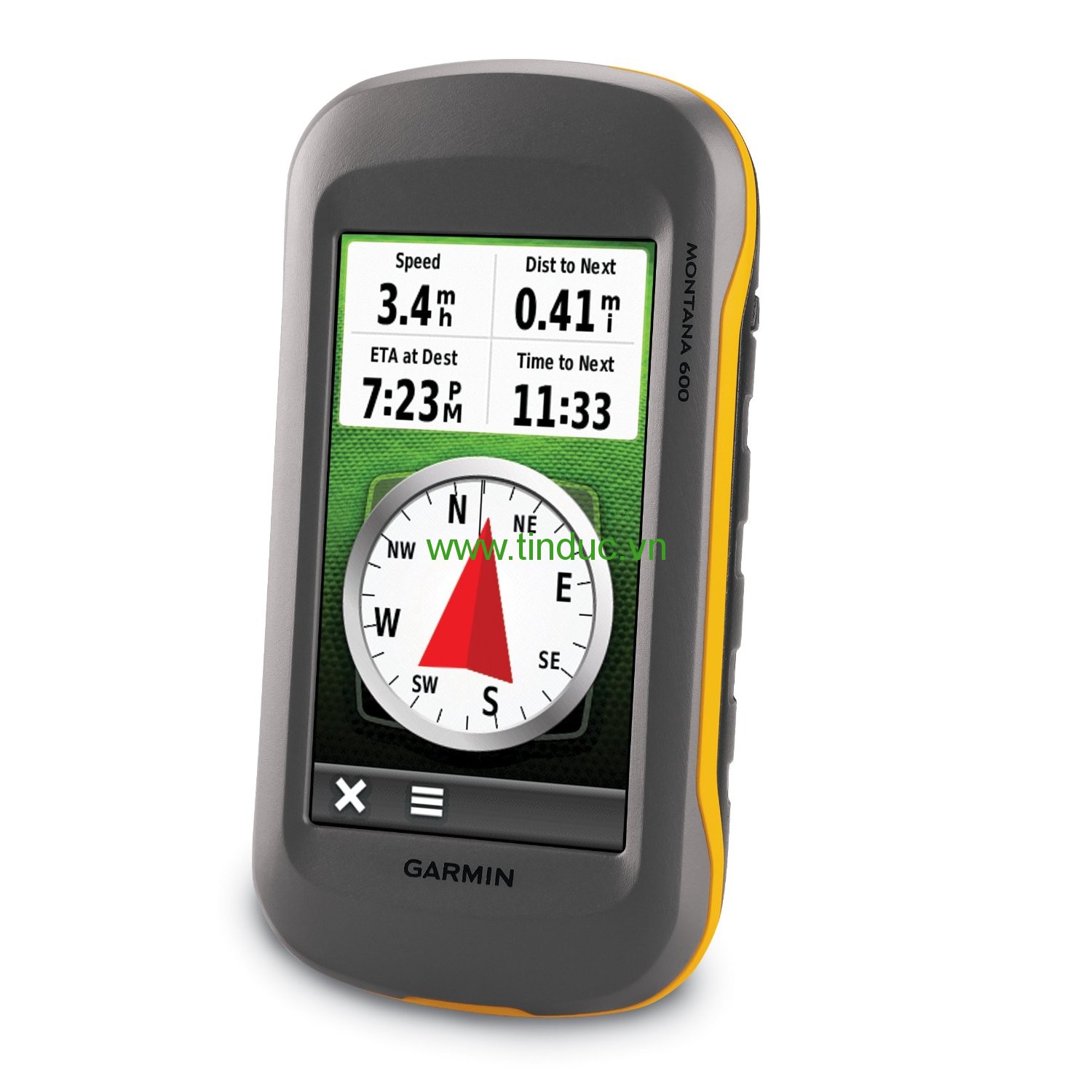
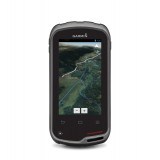
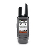
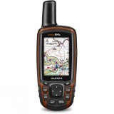
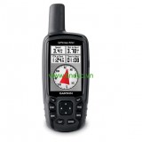
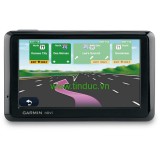
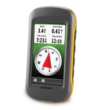
Công ty Tín Đức giới thiệu tới Qúy khách hàng Máy định vị cầm tay GPS Garmin Montana 600
- Màn hình 65.000 màu TFT, độ phân giải: 272 x 480 pixels
- Màn hình cảm ứng, kích thước: 5.06 x 8.93 cm
- Có chức năng xem hình.
- Bộ nhớ trong 3.0 GB; Thẻ nhớ 1.0 GB + Bản đồ Việt Nam;
- Lưu nhớ được 4.000 điểm , mỗi điểm có thể đặt tên đặt biểu tượng thích hợp
- Số lộ trình: 200 lộ trình có thể đảo chiều
- Lưu lại được trong máy 200 khu vực đo; 10.000 điểm nhớ trên track log;
- Tự động vẽ lưu lại khu vực đo, khảo sát; Tính chu vi và diện tích khu vực đo trong máy;
- Hệ tọa độ: Lat/Lon, UTM/UPS, Maidenhead, MGRS, Loran TDs, VN2000
- Nhận cùng một lúc 12 kênh và sử dụng tối đa 12 vệ tinh để tính toán và cập nhật vị trí
- Giao diện với phần mềm Mapsources, WorlMap, BlueChart ;
- Trao đổi dữ liệu với máy tính qua cổng USB
- Trao đổi dữ liệu giữa hai máy GPS qua cổng wireless;
- Có cổng kết nối với ăng ten ngoài;
- Anten được thiết kế gọn trong máy, độ nhạy cao, cho tín hiệu tọa độ từ 30 đến 60 giây khi mở máy;
- Độ chính xác từ 3 - 5m;
- Báo cao độ, áp suất qua một sensor trong máy;
- La bàn điện tử được thiết kế sẵn trong máy
- Vỏ máy đạt tiêu chuẩn chống nước IPX7
- Nguồn điện: sử dụng pin sạc (lithium-ion) thời gian sử dụng có thể tới 16 giờ; hoặc pin tiểu (03 pin AA), thời gian sử dụng có thể tới 22 giờ
|
Model |
Montana™ 600 |
|
Unit dimensions, WxHxD: |
2.9" x 5.7" x 1.4" (7.48 x 14.42 x 3.64 cm) |
|
Display size, WxH: |
2"W x 3.5"H (5.06 x 8.93 cm); 4" diag (10.2 cm) |
|
Display resolution, WxH: |
272 x 480 pixels |
|
Display type: |
bright, transflective 65k color TFT, dual-orientation touchscreen; sunlight readable |
|
Weight: |
10.2 oz (289 g) with included lithium-ion battery pack; 11.7 oz (333 g) with 3 AA batteries (not included) |
|
Battery: |
rechargeable lithium-ion (included) or 3 AA batteries (not included); NiMH or Lithium recommended |
|
Battery life: |
up to 16 hours (lithium-ion); up to 22 hours (AA batteries) |
|
Waterproof: |
yes (IPX7) |
|
Floats: |
no |
|
High-sensitivity receiver: |
yes |
|
Interface: |
high-speed USB and NMEA 0183 compatible |
|
Basemap: |
yes |
|
Preloaded maps: |
no |
|
Ability to add maps: |
yes |
|
Built-in memory: |
3.0 GB |
|
Accepts data cards: |
microSD™ card (not included) |
|
Waypoints/favorites/locations: |
4000 |
|
Routes: |
200 |
|
Track log: |
10,000 points, 200 saved tracks |
|
Automatic routing (turn by turn routing on roads): |
yes (with optional mapping for detailed roads) |
|
Touchscreen: |
yes |
|
Electronic compass: |
yes (tilt-compensated, 3-axis) |
|
Barometric altimeter: |
yes |
|
Camera: |
no |
|
Photo navigation (navigate to geotagged photos): |
yes |
|
Picture viewer: |
yes |
|
Custom maps compatible: |
yes |
|
Geocaching-friendly: |
yes (paperless) |
|
Outdoor GPS games: |
no |
|
Hunt/fish calendar: |
yes |
|
Sun and moon information: |
yes |
|
Tide tables: |
yes |
|
Area calculation: |
yes |
|
Custom POIs (ability to add additional points of interest): |
yes |
|
Unit-to-unit transfer (shares data wirelessly with similar units): |
yes |
|
Garmin Connect™ compatible (online community where you analyze, categorize and share data): |
yes |
Bạn chưa xem sản phẩm nào


Hiện tại chưa có ý kiến đánh giá nào về bài viết này. Hãy là người đầu tiên chia sẻ cảm nhận của bạn.
 Ảnh 1/1
| Thông tin công ty | Hướng dẫn mua hàng | Chính sách công ty |